The Hidden Draft Sheets of the Veldkamp Mapping Hall
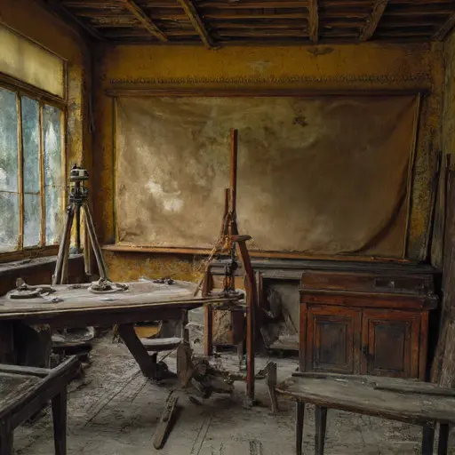
A hush lingers through the Mapping Hall, where a torn folio shows half-drawn coastlines beside a misplaced compass. Ink crusts around the nibs, stiff as if their owner stepped away for a moment that never ended.
Bearings of a Cartographer
The instruments belonged to Leendert Veldkamp, cartographer (b.
1872, Utrecht), who trained under a provincial surveyor yet worked with meticulous restraint. His small notes—Dutch abbreviations neat and exact—record tasks for clients and mention his brother, Harm Veldkamp, “assist with elevation checks,” implying a structured, familial rhythm.
Lines Measured with Intent
A cabinet of Dutch-ruled grid sheets shows uniform pencil shading, corrected by firm strokes. A pair of calipers rests atop a folder marked simply “tidal study.” Along the baseboard, a sliver of parchment reveals carefully inked meridians trimmed too close, perhaps under deadline pressures.

Drift Toward Uncertainty
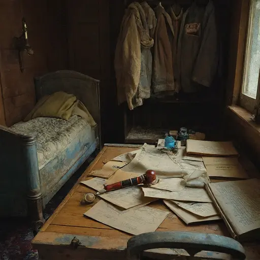
Within a portfolio marked “harbor revisions,” Leendert’s hand begins to waver. Ink pools at the ends of his lines. Tidal annotations contradict earlier measurements. A marginal note—“verify elevation with Harm—dispute unresolved”—is scratched nearly illegible. A weighted straightedge lies askew atop a blot where seawater-blue ink bled without being blotted.
In the Mapping Hall’s final drawer, an unfinished chart lies pinned beneath a brass weight, its shoreline spiraling into erasure. Nothing clarifies Leendert’s abrupt cessation of work, nor Harm’s silence thereafter.
The rooms accept their abandonment, bearings unset, drafts forever awaiting correction.
