Residual Order in the House of the Mosaic Frequency Cartographer
The tiles are still arranged by color band.
Not as decoration.
But as data.
Each fragment carries a position, a tone, and a mapped frequency signature recorded before placement.
This house belonged to Kaori.
She worked as a mosaic frequency cartographer, mapping environmental and acoustic resonance patterns through ceramic tile arrangements used in architectural acoustics and terrain modeling systems.
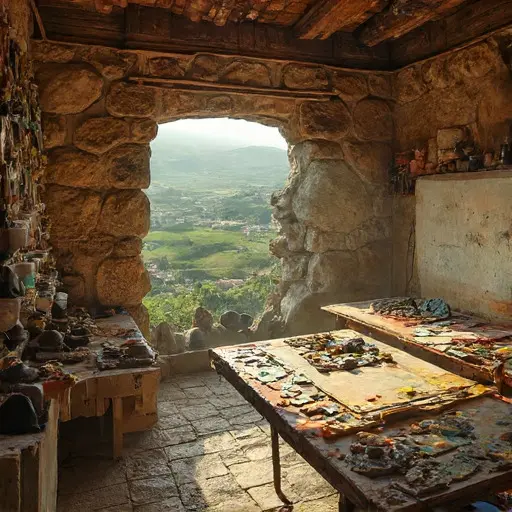
The studio occupied the central upper floor of the house where sound and light both remained stable across seasons.
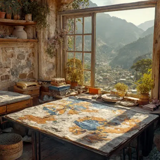
Drafting tables stretched wall to wall. Ceramic shards were sorted into labeled trays. Frequency scanners rested beside inked grid maps that translated terrain vibration into visual mosaic structures.
The house did not build images.
It built spatial sound records.
Beneath the Resonance Grid Table
Kaori worked most often beneath the Resonance Grid Table.
The reinforced wooden surface was used to align frequency readings with physical terrain mappings, converting acoustic resonance data into structured mosaic coordinates.
Her partner died during a regional tremor event years earlier when an unexpected vibration shift destabilized a nearby hillside settlement.
After that, she stopped participating in field resonance surveys.
For years, the profession remained useful.
Architectural engineers, environmental planners, and cultural preservation teams relied on mosaic frequency mapping to design structures that responded to localized acoustic behavior in hillside and valley regions.
Then digital simulation replaced physical resonance mapping.
Advanced acoustic modeling systems began replicating environmental soundscapes virtually, removing the need for ceramic-based physical frequency translation.
Kaori continued anyway.
Even without clients.
Even without institutional relevance.
But the decline extended beyond technology.
The terrain itself became unstable.
Increased seismic microvariations in the region altered long-term resonance consistency, making traditional mosaic frequency baselines unreliable for comparative mapping across seasons.
Then access collapsed.
A series of controlled structural evacuations were issued after repeated hillside shifts caused partial destabilization of older terraced zones, limiting entry to many historic mapping studios.
Kaori stayed inside through extended periods of aftershock monitoring, continuing to document frequency shifts from archived datasets even after field input ceased entirely.
During a final regional vibration cascade, multiple microtremor events overlapped, rendering existing resonance grids incompatible with real-time terrain response.
She attempted to finalize a full acoustic mosaic reconstruction at the Resonance Grid Table during a prolonged infrastructure shutdown caused by cascading seismic sensor failures.
She died before the final mapping grid could be completed.
No engineering institute retrieved the studio records.
The house remained intact above the valleys.
The ceramic fragments remain sorted by resonance.
The grid maps stay half-aligned.
And at the Resonance Grid Table, Kaori’s unfinished mosaic frequency record continues waiting in silence—holding the last spatial sound she never returned to complete.