Devouring Stillness in the House the Map Engraver Never Filed Away
The metal plates still carry pressure marks.
Not printed.
Not erased.
Just etched deeply enough that light catches the grooves even in a dim room.
This house belonged to Halvar.
He worked as a topographic map engraver, producing precision terrain maps for mountain expeditions, border surveyors, and alpine infrastructure builders.
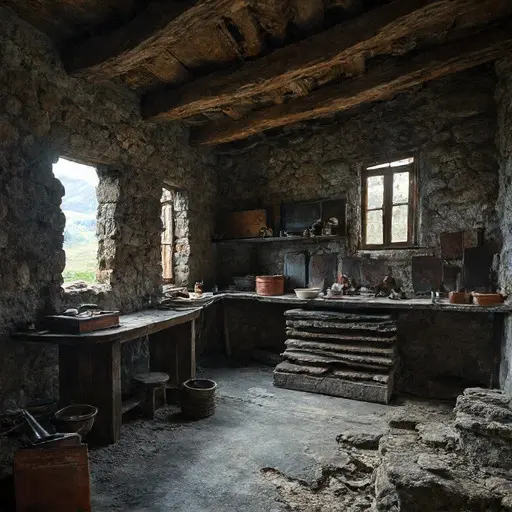
The workshop occupied the lowest stone room of the house where vibration from wind and weather was minimal.
Copper sheets were stacked in labeled trays. Engraving needles rested beside magnifiers. Wax sealing tools lay near partially finished map plates showing ridgelines, passes, and elevation shifts.
The house existed to translate terrain into permanence.
Beneath the Ridge Coordinate Table
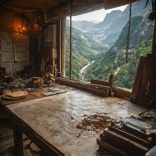
Halvar worked most often beneath the Ridge Coordinate Table.
The heavy iron-framed desk was where he aligned engraved plates with field survey data brought in by expedition teams crossing unstable alpine terrain.
His wife died during a long winter isolation season caused by blocked mountain passes.
After that, he rarely left the workshop during snow cycles.
For years, the profession remained essential.
Surveyors, builders, and border officials depended on engraved topographic maps for infrastructure planning across regions where satellite imaging was unreliable due to terrain distortion.
Then digital mapping replaced engraving.
High-resolution geospatial systems and automated terrain modeling eliminated the need for hand-etched copper maps, replacing physical cartography with real-time virtual overlays.
Halvar continued anyway.
Even without commissions.
Even without demand.
But the decline was not only technological.
The mountains themselves became less stable.
Increased seismic microactivity and seasonal rock shifts altered traditional elevation references, making older engraved datasets less reliable for modern navigation standards. Entire passes were rerouted or closed due to unpredictable slope failure zones.
Then his body weakened.
Years of fine copper dust exposure and cold workshop conditions contributed to chronic respiratory decline that limited his working hours.
One final mapping commission arrived during an extended alpine closure period when all mountain passes were officially shut due to repeated rockslide events.
Halvar attempted to complete a full ridge reconstruction plate set based on the last surviving expedition data before communication lines failed.
He died at the Ridge Coordinate Table before filing the final map archive.
No survey authority retrieved the workshop.
The plates remained unarchived.
The mountains changed again.
The copper plates remain etched.
The coordinate charts stay unfiled.
And at the Ridge Coordinate Table, Halvar’s unfinished map continues waiting in silence—holding the last terrain he never returned to engrave into record.